
Twelve Debris-Flow Crossings on FR-088: Mapping What the Babylon Fire Left on the ADT
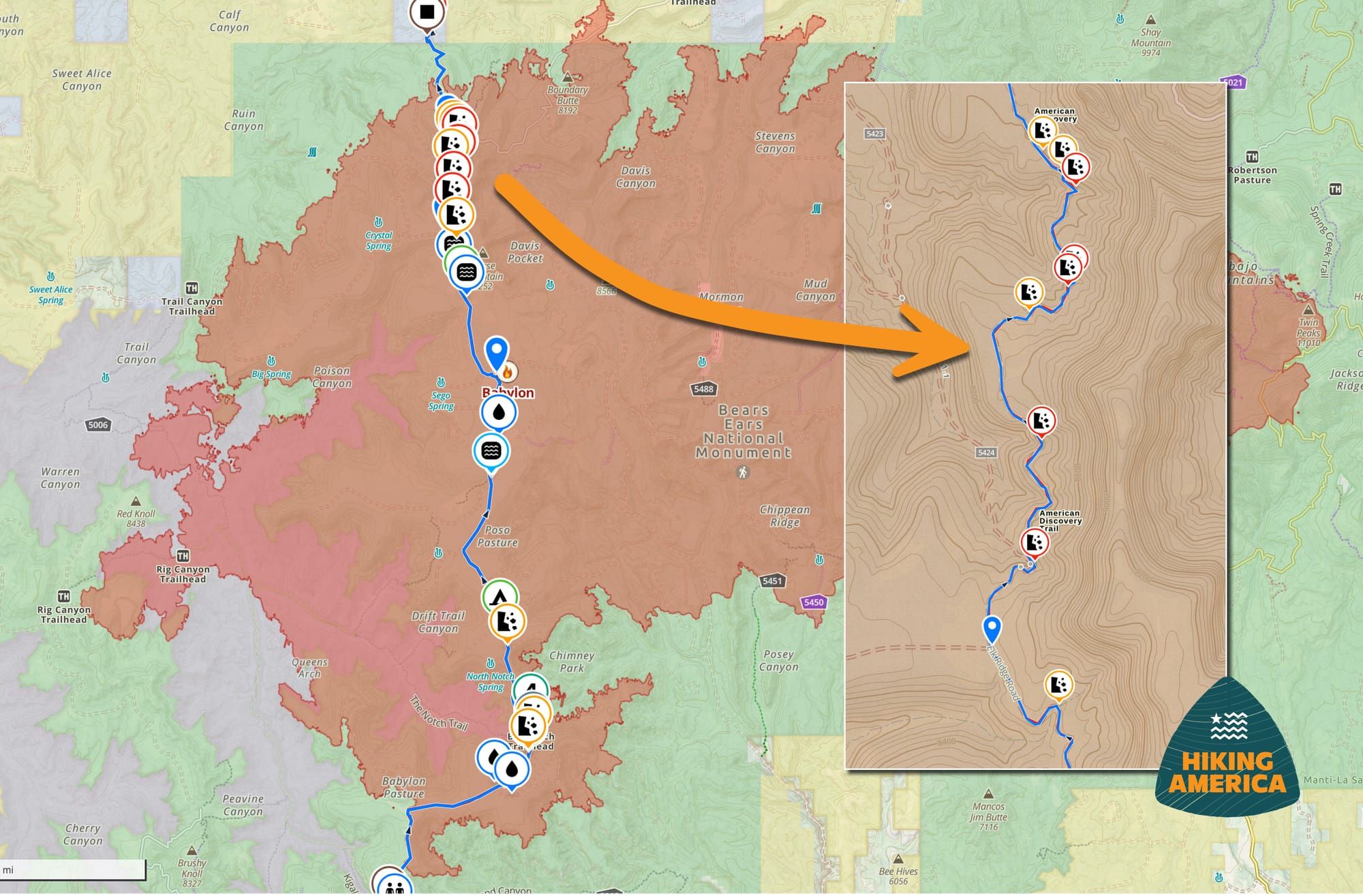
The Forest Service reopened Elk Ridge on August 20. We ran the USGS debris-flow modeling against our Segment 5 track and found 12 crossings on FR-088, 9 of them inside 2.7 miles.

The Forest Service rescinded the Babylon Fire closure on August 20, and Elk Ridge is walkable again. The road is not what it was in May.
The fire started June 26 from a lightning strike and burned across Elk Ridge, Dark Canyon Wilderness, and Bears Ears National Monument. Utah Segment 5 runs 18.6 miles of that burned ground. Of the burn, 51 percent had moderate soil burn severity, 5 percent had high severity, and the Burned Area Emergency Response (BAER) team assessed an elevated risk of debris flows at 5 to 10 years.
What a debris flow actually is
Not a flood with sticks in it. A debris flow is a moving mass of water, mud, sand, rock, and burned timber, often more than half solids by volume, behaving closer to wet concrete than to a creek. It comes down a channel in surges, usually with a front of boulders and logs pushed ahead of the slurry, and it moves faster than you can run. Water you could wade becomes something that carries vehicles.
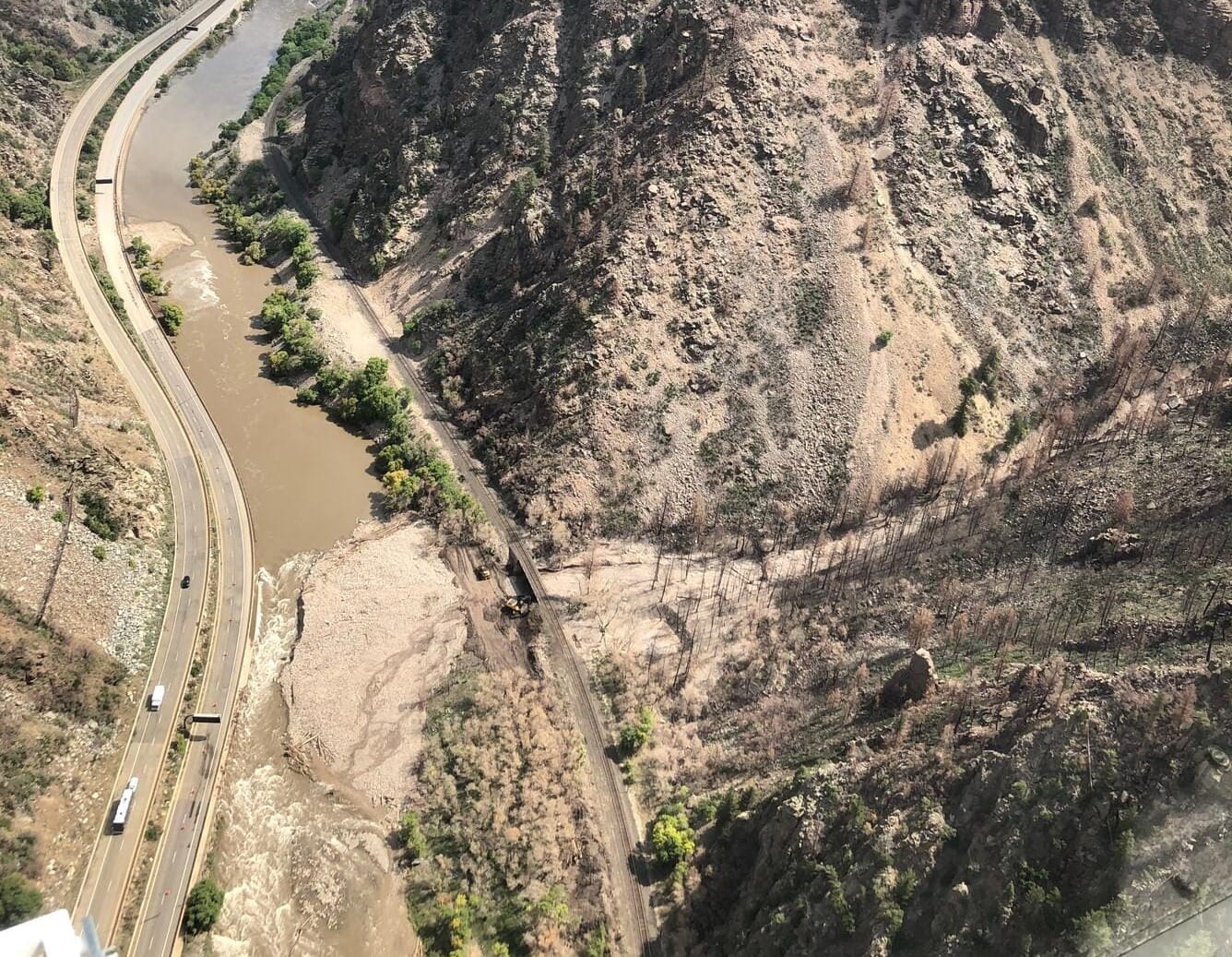
Fire is what makes it possible. Burning strips the vegetation and litter that held soil in place, and the heat can bake a water-repellent layer into the ground. Rain that would have soaked into a healthy slope sheets off instead, picking up ash and loose soil as it goes until the mix is no longer really water. That is why a storm producing nothing but a puddle in an unburned canyon can fill a burned one.
The part that catches people is the timing. The rain does not have to fall on you. A cell sitting over the ridge above can put a flow into a wash while the sky where you are standing is still clear, and it will arrive within minutes of the rain starting rather than building over an hour. There is no outrunning it downcanyon. The only move is up, out of the channel bottom, before it starts.
Local coverage in late July named 5 drainages with the highest debris-flow potential inside the burn. Horse Mountain, North Cottonwood Creek, Cottonwood Creek, Davis Canyon, Stevens Canyon. The Forest Service report said those names came from its own source: the USGS debris flow model.
On July 25, the U.S. Geological Survey published a post-fire debris-flow hazard assessment for the Babylon Fire. It models 9,919 stream segments and 776 drainage basins across the burn. For each one, it estimates how likely a debris flow is under a range of storms, how much material would come down, and how much rain it would take to trigger one. Public domain, free to anyone, with a DOI. Almost nobody uses it because it arrives as a shapefile rather than a map.
We ran all 9,919 segments against our Segment 5 master track.
Where the route meets the burn
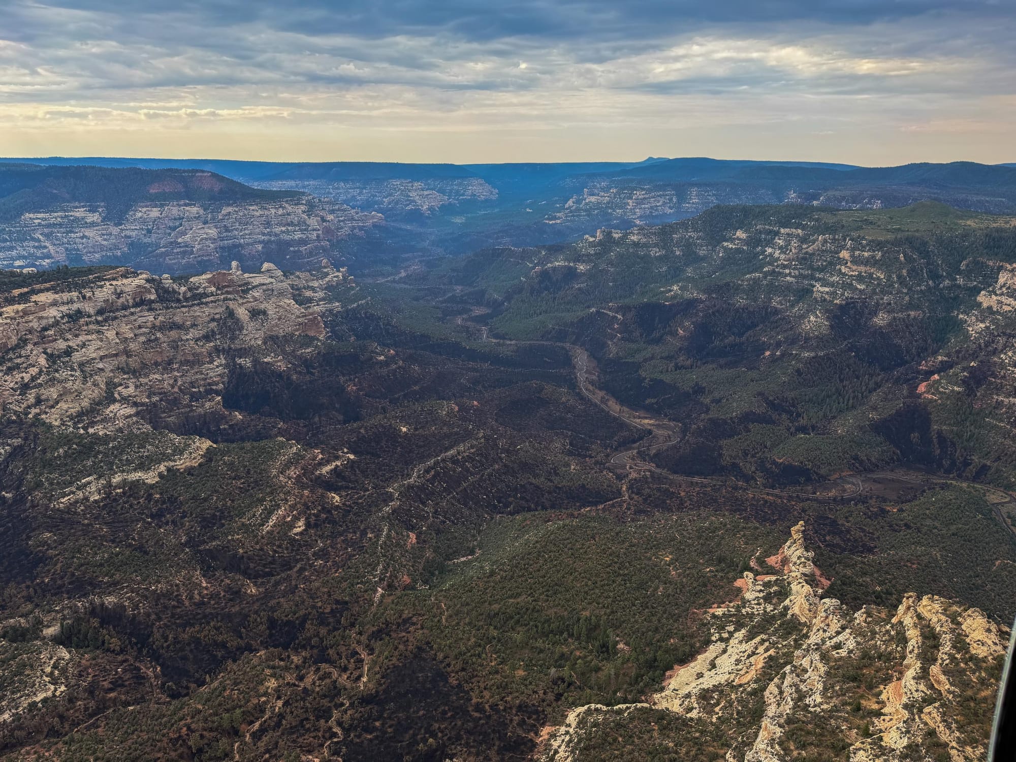
Segment 5 enters the burn perimeter at westbound mile 99.5 and leaves it at 117.0. Most of that is FR-088 over Elk Ridge, which carries 17.8 of the 18.6 burned miles. Beef Basin Road, FR-095, carries the remaining 1.1 at the north end.
Eighty-six modeled washes cross the ADT inside the burn. Most need a storm the Colorado Plateau rarely produces. But twelve places are worth planning around, covering 24 washes, and every one of them sits on FR-088. All are now indicated in our Turn-By-Turn directions and Gaia GPS data for the American Discovery Trail.
Nine of the 12 fall within 2.7 miles of each other. The other 3 sit roughly 10 miles south, far enough from the cluster to be walked past without a thought.
What the numbers mean
One burned wash crosses the road at westbound mile 101.1. About 0.17 inches of rain falling in 15 minutes gives that crossing roughly a 50/50 chance of producing a debris flow.
That is not a downpour. It is an ordinary summer thunderstorm burst in southeast Utah, the kind that soaks you and moves on in 10 minutes. Under a harder cell, the probability climbs past 95 percent, and the modeling puts up to 3,300 cubic meters of water, mud, rock, and burned timber in the channel. Roughly 330 dump truck loads.
Five of the 12 trigger between 0.17 and 0.19 inches. The rest need between 0.20 and 0.26. That is a difference no hiker can measure standing in the rain, which is why we've included all 12 in our data rather than only the worst 5.
Even the smallest storm USGS modeled already puts these crossings near a coin flip.
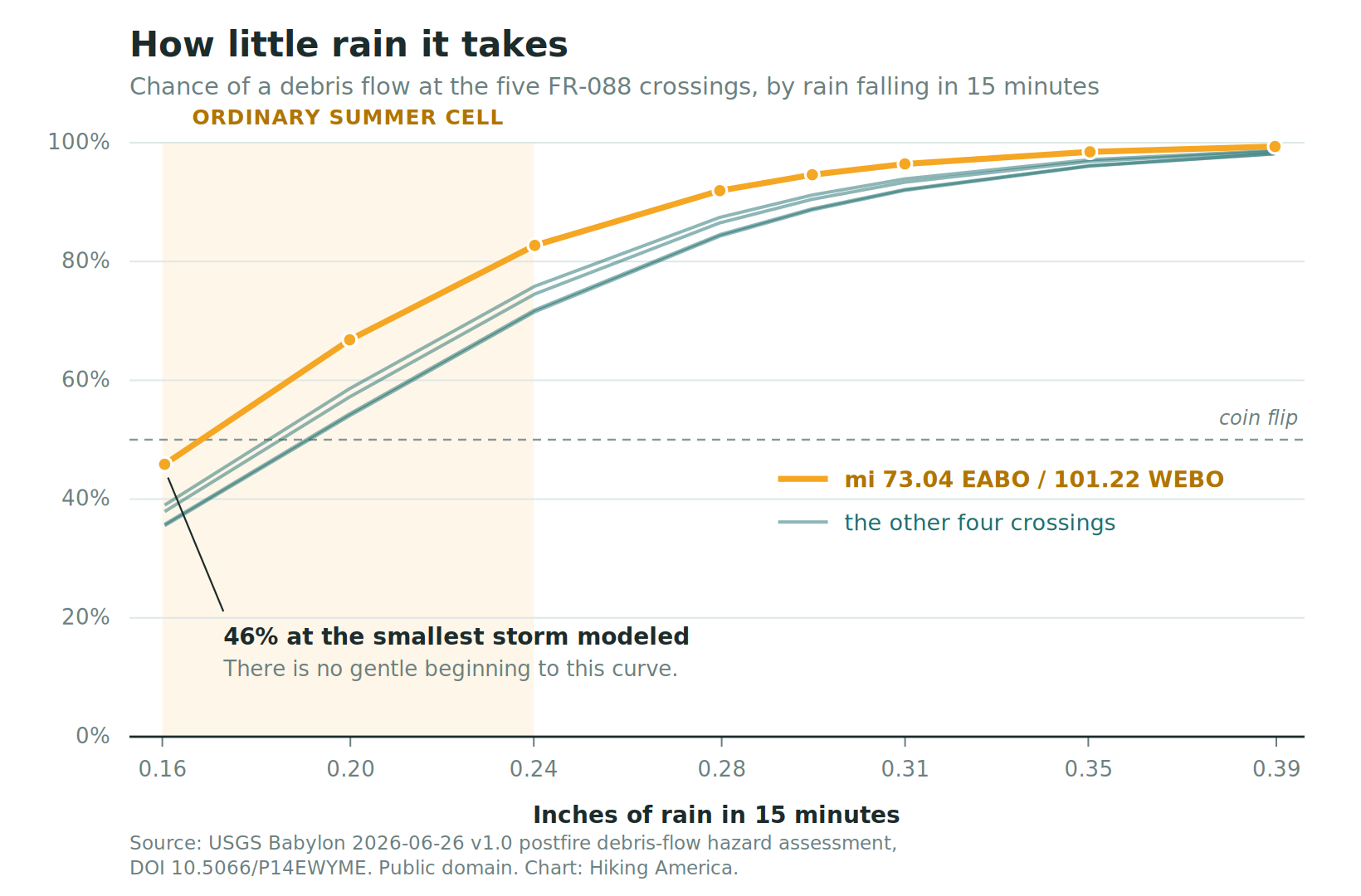
The chart shows something that surprised us. The curve does not start low and climb. At the smallest storm modeled, 0.16 inches of rain in 15 minutes, mile 101.3 is already at 46 percent. There is no gentle beginning. The modeling never shows these washes at low risk, because the lightest storm worth modeling is already enough.
Debris flows arrive within minutes of the rain starting, and they move faster than you do.
What this changes on the ground
Nothing about the route. FR-088 is open, and the tread is the same tread.
What changes is where you camp and what you do when the sky builds. Do not camp in or beside those washes. If a cell develops while you are between the junction and eastbound mile 70.9, get out of the channel bottom and onto higher ground and let it pass. Check the forecast before you enter the burn, because that 2.7 miles is ground you want to be through rather than sitting in when the afternoon builds.
Five to 10 years is the window the BAER team gave. So this is not just a 2026 problem.
Four more things from the BAER report
- Equipment operators are working the roads through the burn area. The Forest Service confirmed to us on August 28 that nothing is closed and asked that people stay alert around the crews and machinery.
- The fire exposed old mine sites, and the report flags a risk of exposure to concentrated arsenic at these sites, with stabilization treatments recommended to prevent erosion from mobilizing it. Walk past rather than explore, and do not draw water directly below one.
- Fire-killed trees are standing across the burn. The report recommends felling them where work crews will operate. Everywhere else, they are still there. Do not camp under snags, and think hard about camping in the burn at all on a windy night.
- Water quality took a hit. The assessment found increased flows and high turbidity, with elevated ash, fine sediment, nutrients, and dissolved organic carbon, and expects several years before that recovers. Sources through the burn will run dirtier than your notes suggest. Let water settle before it goes through a filter.
Could it close again? The BAER team recommended gates at some entry points, but those are intended for motorized use, keeping ATV and dirt bike routes closed until vegetation stabilizes the soil. Nothing in the report targets foot travel. That said, closure orders get signed on short notice, so check the alerts page before you commit to Elk Ridge.
In the data now
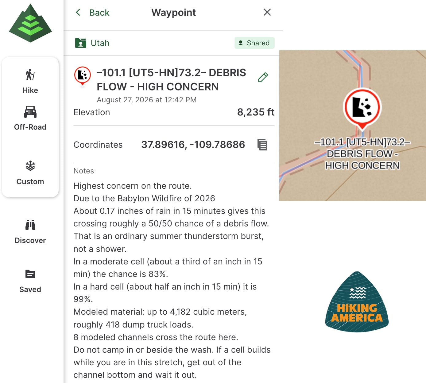
All 12 crossings are in the waypoint layer for Utah, each carrying its trail mile in both directions, the road it sits on, how many washes cross there, the rainfall amount that triggers it, and the probability under a moderate and a hard cell. They are in the turn-by-turn guide at the same miles. If you already have the Utah data loaded in Gaia, sync, and they will appear.
The Babylon Fire alternate is still there and still recommended for anyone who would rather not think about any of this. It leaves the official route at Homewater Spring in Ruin Park, rejoins at the Sundance Trail trailhead on Woodenshoe Road, runs 39.1 miles, and crosses no burned ground. It also carries no documented water, which is its own problem to solve.
If you're planning around the reroute, run the Segment 5 track through the GPX Elevation Gain Calculator to see what the climbing actually costs on the alternate.
USGS did the science. We turned it into trail miles.
Hike Your Hike - John.
Source
USGS Babylon 2026-06-26 v1.0 postfire debris-flow hazard assessment, DOI 10.5066/P14EWYME. Released to the public domain under CC0. Soil burn severity, water quality, mine site, and danger tree findings from the Babylon Fire BAER public report. Closure status from Forest Order 04-10-26-05-07.

