
Colorado Reroute: From Harrowing Roads to Amazing Views
Explore a breathtaking yet challenging section of the American Discovery Trail in Colorado. Learn about Matthew Hengst's trek, a safer alternate route between Cascade and Manitou Springs, and the latest trail updates across the ADT.

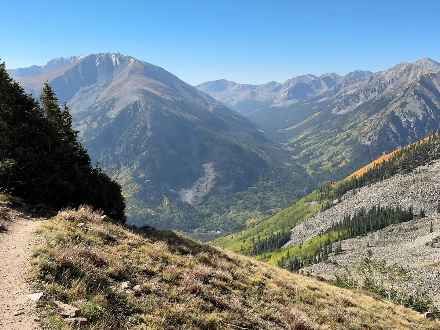
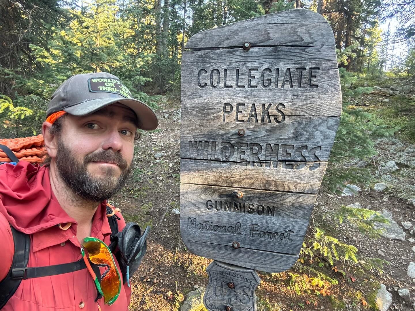
Matthew Hengst recently made his way through one of the most breathtaking sections of the Colorado Rockies, where the American Discovery Trail (ADT), the Continental Divide Trail (CDT), and the Colorado Trail (CT) converge for several unforgettable miles. This portion of the journey is known for its spectacular scenery—towering peaks, alpine meadows, and pristine wilderness that define the beauty of Colorado's high country.

However, the Colorado scenery along part of the ADT differs entirely for a few miles. 😲
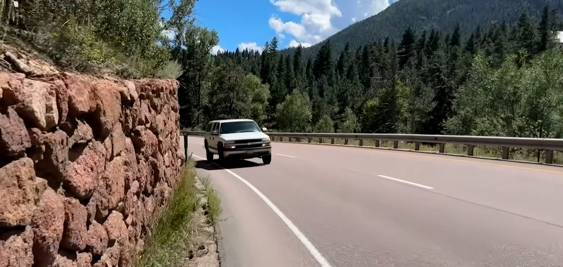
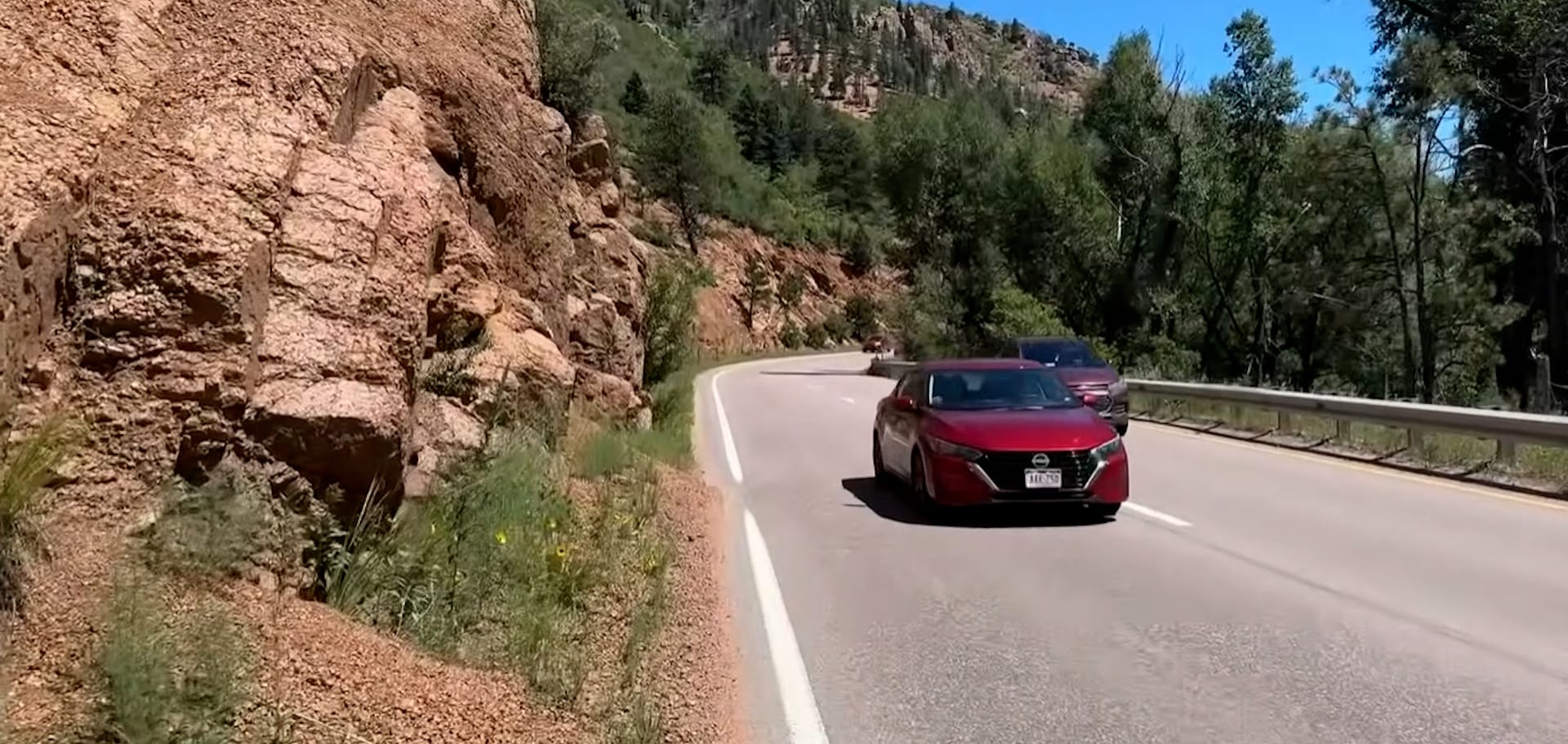
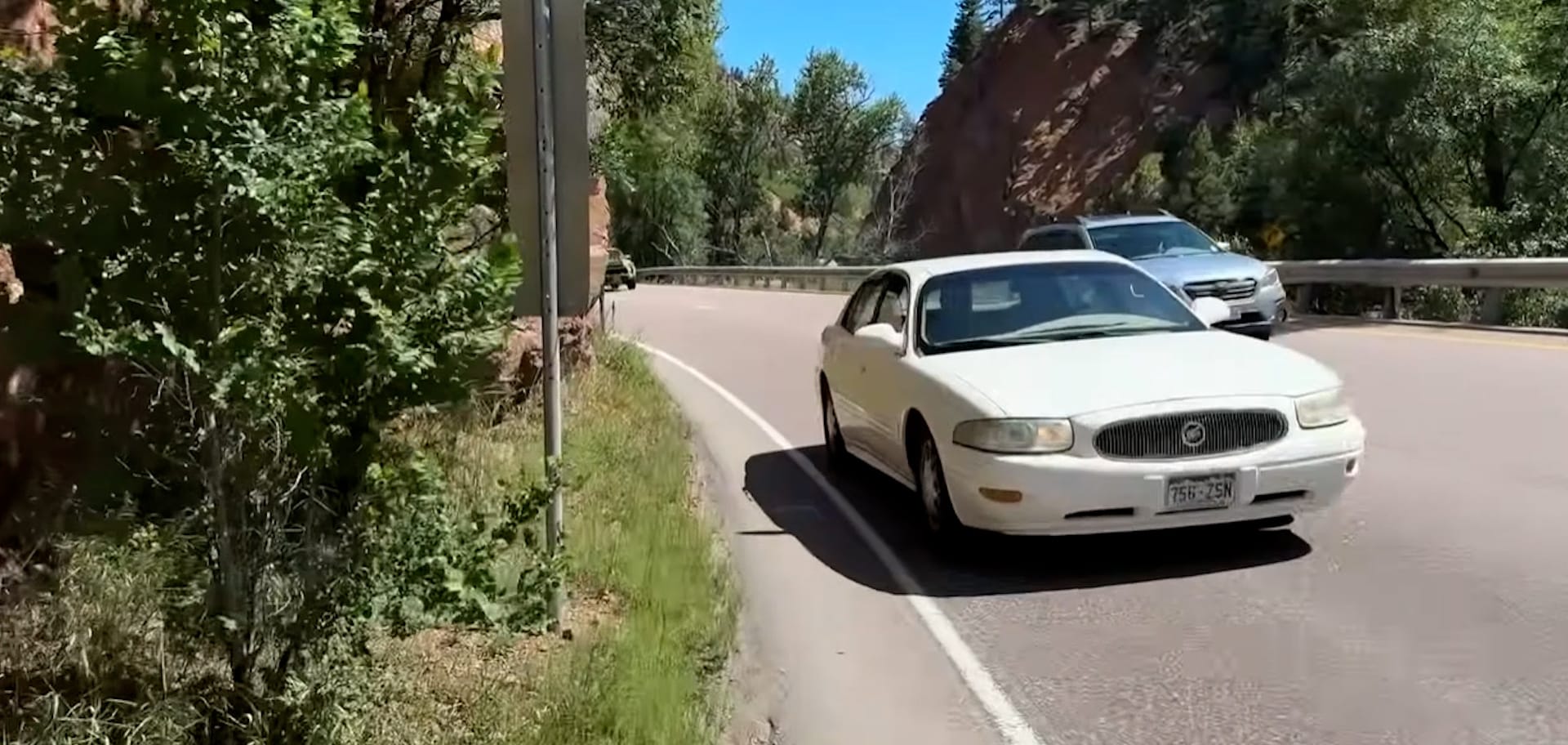
55 mph US 24 is the ADT route between Cascade and Manitou Springs, Colorado - Screenshots from Matthew Hengst Video
Colorado Segment 3
Cascade to Manitou Springs Alternate
Matthew faced significant challenges during his trek from Cascade to Manitou Springs. "I think this is in the running for my least favorite road walk so far," Matt said with a nervous laugh in his video of the section. The route follows US 24, a notoriously dangerous road with no shoulders and several blind curves, and creates a harrowing experience.
We've developed a new route that offers a safer alternative.
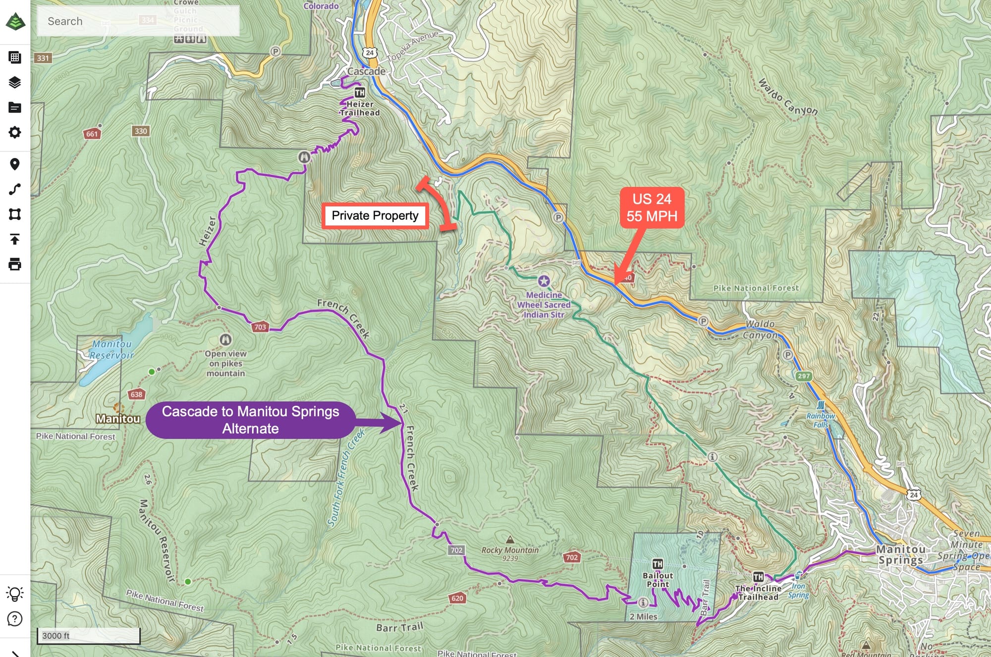
Though longer than the current ADT route, the alternate (in purple) follows the Heizer and French Creek trails in Pike National Forest. This provides a safer trip with the added benefit of access to views of Pikes Peak and the famed The Incline stairs, where you can ascend or descend into Manitou Springs if you are looking for an additional challenge.
The Ute Pass Trail (above in green) would offer a much shorter bypass of US 24 in this area. Unfortunately, a small section of private property at the northwest end currently blocks access to this potential route. Here's hoping that future negotiations might open this area to hikers, as it would create a more direct and scenic alternative.
For now, we recommend the Heizer and French Creek route for those prioritizing safety, pristine views of Pikes Peak, and access to Manitou Springs, including The Incline. Though it adds some mileage, it guarantees a safer and more enjoyable hiking experience.

Utah
Segment 1
Water reports from Marshall Travis include a piped spring to a pond. We've had over three consecutive years of updated water reports from three different summer months for this spring, so it's a reliable water source. We've added all of Marshall's dispersed camping locations on the Bureau of Land Management land. He found a covered picnic table in the old Ghost Town of Frisco. He recommended Penny's Diner in Milford as previous hikers have for a good place for a good meal and a chance to recharge battery packs.
Nevada
Segment 7
Marshall Travis crossed into Nevada and reconfirmed water sources on the approach to Cooper Summit. He also found that the Cave Lake campground was still shut down due to the work of the Cape Lake Dam, so he was forced to move on to the Elk Flat campground and pitched his tent next to the shower house.
Segment 6
Added the Jackson House Hair Salon, where Marshall 'got a decent haircut.'
Segment 4 Alternate
This week, Marshall Travis used this alternate on his trip over the Toiyabe Range in central Nevada. He provided very helpful water and trail condition information. This is a solid alternative until the trail through Arc Dome reopens - if and when.
This alternate was created last year to aid Briana DeSanctis' ADT trip. The new route was because the main American Discovery Trail route was destroyed east of Arc Dome by a rock slide caused by an atmospheric river and subsequent avalanche last year. Mike Crowley confirmed the route was still under unstable boulders and a hazardous scree field in his crossing earlier this year.
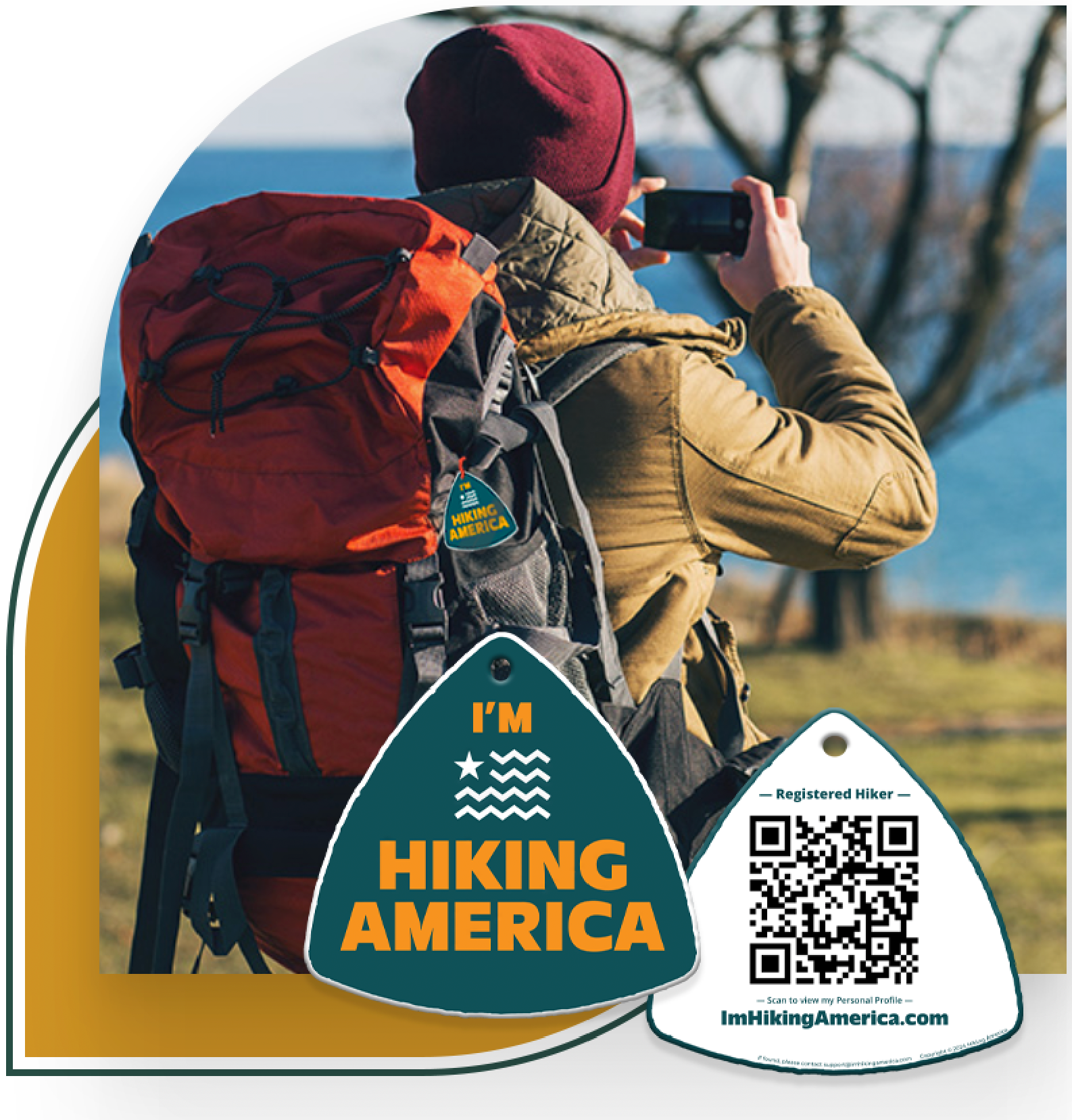
Identity for Every Adventure
Ensure your Safety and Recognition on Every Hike!
Get your Custom QR Code Tag! Only $18 for a Limited Time!
Always Free to Hiking America Members.
California
Segment 1
Converted to dual direction in both turn-by-turns and Gaia GPS.
Hike Your Hike - John.
[PARTNERS]


