
Gilbertville to Brandon, Iowa Detour
A bridge replacement and culvert construction project has closed an 18-mile section of the Cedar Valley Nature Trail.


Due to a construction project that involves replacing a bridge and rehabilitating a culvert, an 18-mile section of the Cedar Valley Nature Trail is currently closed. As a result, hikers following the American Discovery Trail will need to take a detour that follows a series of rural roads between Gilbertville and Brandon.

The closure is expected to last into the summer.
Hikers can continue along the trail by following the posted detour; the track and waypoints are available on Hiking America on Gaia GPS.
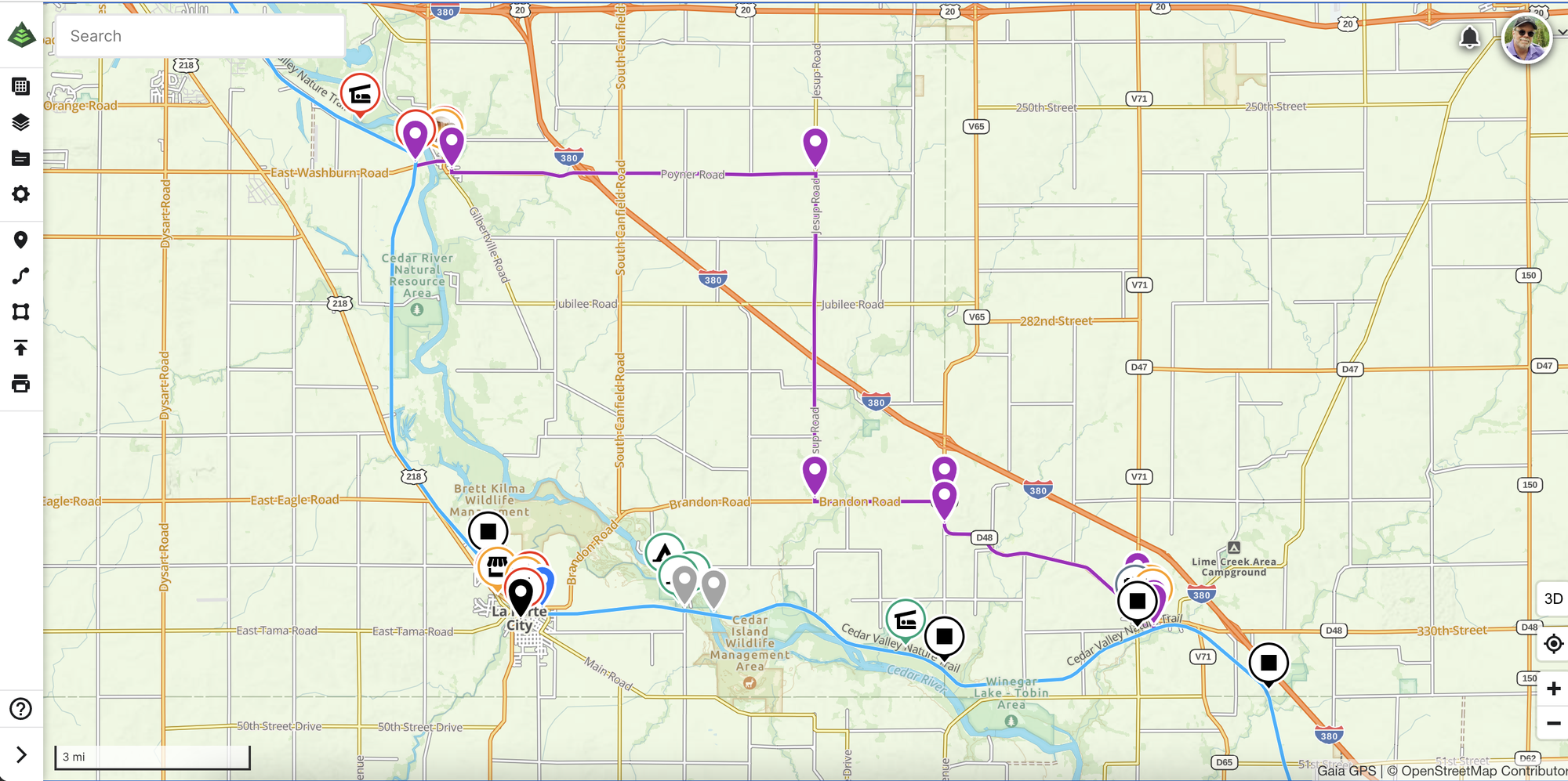
The Iowa Segment 5 guide also includes 11 pages of directions and new maps to help hikers navigate the detour and complete their journey from Gilbertville to Brandon.
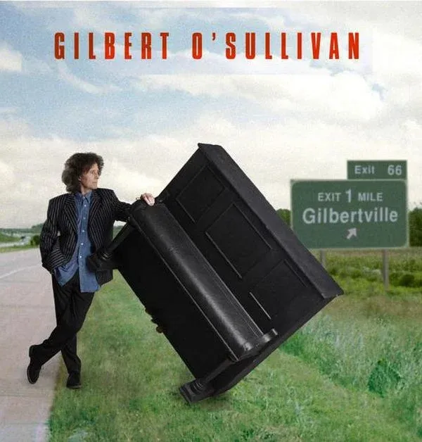
Fun Fact: Gilbertville
Irish-English singer-songwriter Gilbert O'Sullivan named his 2011 album Gilbertville after Gilbertville. The album cover features Exit 66 on Highway 380, the halfway point between Raymond (his real name) and Gilbertville.

Illinois - Southern Route
Segment 1 - Saint Louis to Prairie du Rocher
Added Columbia services information, a stealth camping site, and Fort de Chartres services notes - HT Bernie'22
Segment 2 - Prairie du Rocher to Grand Tower
Added a park with water in Rockwood. Added restaurant outside Prairie du Rocher and legal stealth campsite along the Kaskaskia River.
Ohio
Segment 2 - Cincinnati to Mt Orab
Added new waypoints from Bernie Krausse to include a new Trail Angel in the Williamsburg area.
Segment 10 - Chesterhill to Ohio/West Virginia State Line
Added historical information on the origin and pronunciation of the town of Belpre.
News
Hike Your Hike - John.