
When the Trail Disappears Under Water: How Real-Time Navigation Saved an ADT Thru-Hike 🥾
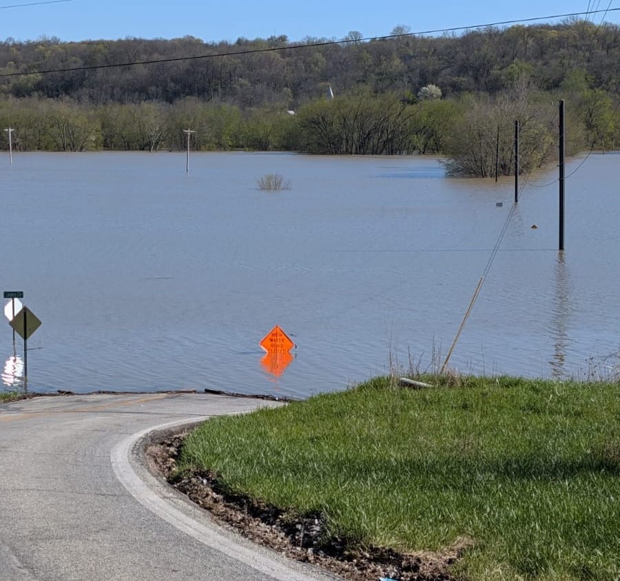
When atmospheric rivers flooded the Ohio River and shut down the Anderson Ferry—a key ADT crossing—thru-hiker Steve wasn't stranded. Within hours, our Gaia GPS waypoints guided him safely around the deluge and back to the trail.


One of the greatest joys of running HikingAmerica.com is being there for hikers when the trail throws unexpected challenges their way—and seeing how our navigation tools help them adapt and continue their journey. ⛰️
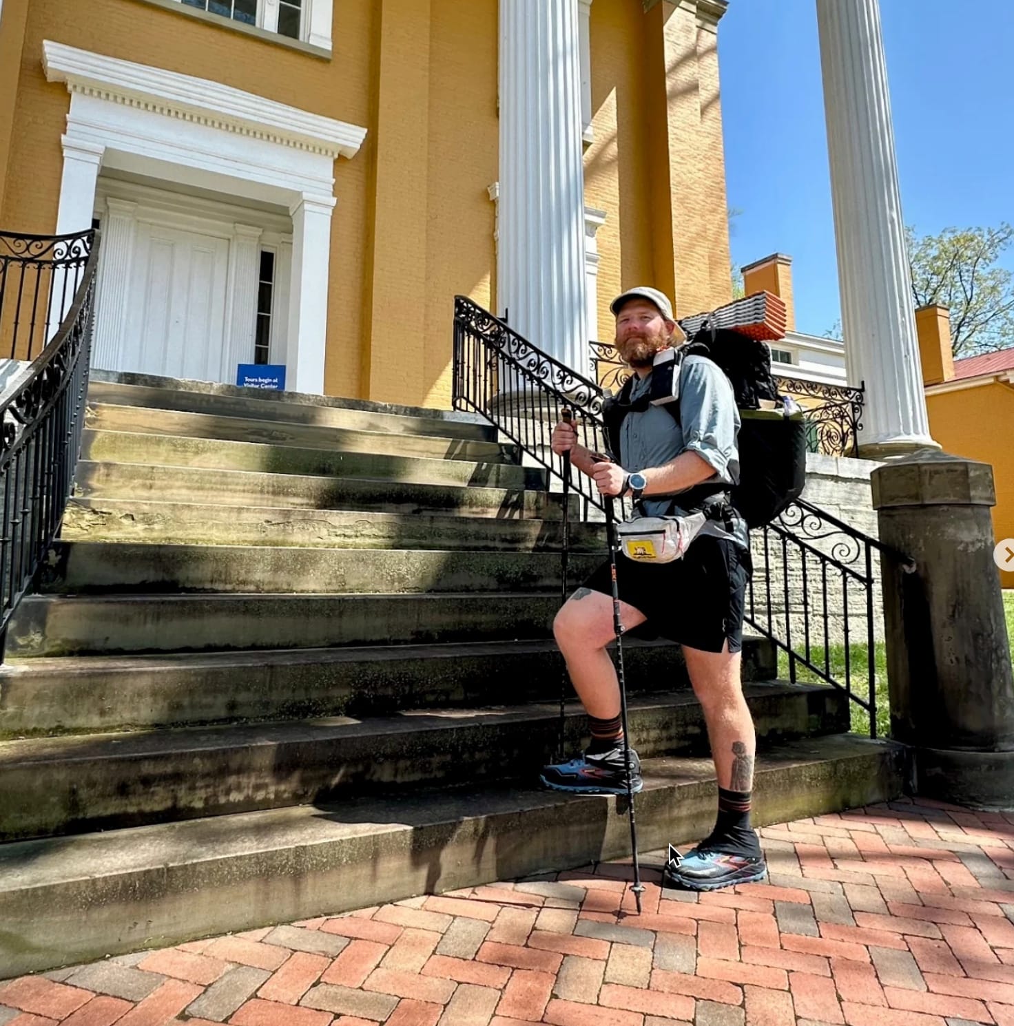
Stephen "SaunterinSteve" Gefell
Westbound - Thru Hiker
Began: February 23, 2025
Support Links: ImHikingAmerica, Instagram, YouTube
Just this week, we worked with thru-hiker, 'Saunterin Steve' Gefell, who was approaching Cincinnati when nature decided to test his resolve. An atmospheric river unleashed its fury, dumping inches upon inches of rain across the region. The Ohio River rose dramatically, completely shutting down the Anderson Ferry between Kentucky and Ohio—a key crossing on the American Discovery Trail.
This is where printed Turn-By-Turn Directions and standard maps would have left Steve stranded.
But with our Gaia GPS waypoints, we took action in real-time. 🧭
Navigation When It Matters Most
Within hours of the Anderson Ferry closure, we:
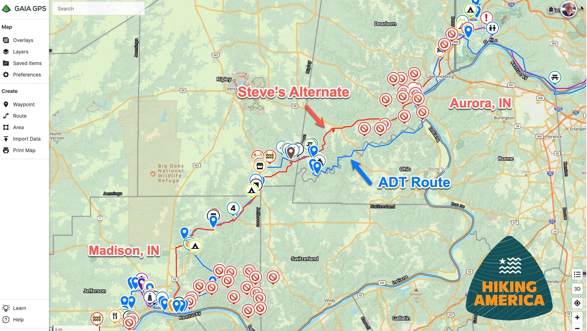
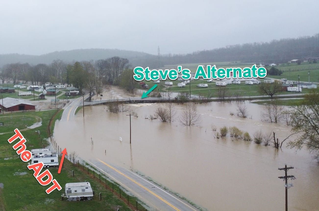
🔹 Created new waypoints 🚫 showing exactly the roads that were closed, providing a quick visual idea of how wide a berth was needed around flooded areas
🔹 A safe detour route could then be mapped - threading the needle through Aurora, Indiana's closed streets, and eventually reconnect with the ADT in Madison, Indiana
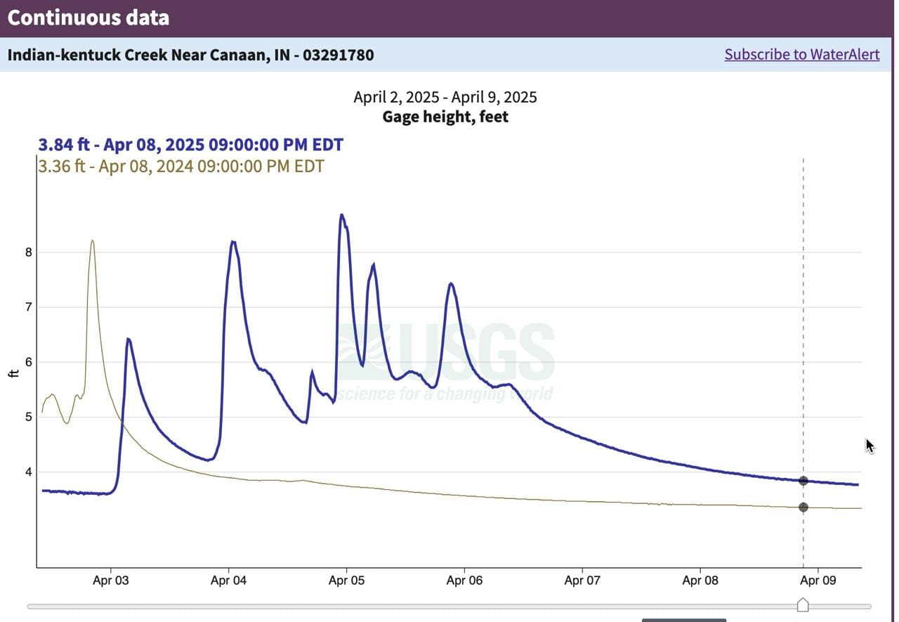
🔹 We also shared river gauge level changes by the hour at other water crossings along the detour to keep Steve's feet dry.
All of this new data will now be preserved for the next time Mother Nature brings a gusher to the region – hikers, Hiking America, on the American Discovery Trail, will have a heads-up on which roads are likely to close and a successful way to get around it all.
Thanks, Steve!
The Gaia GPS Advantage on the ADT
The American Discovery Trail crosses thousands of waterways, urban areas, and diverse landscapes—all subject to changing conditions. That's why static navigation tools simply don't cut it for serious ADT hikers.
What the Hiking America data on Gaia GPS system provides:
⚡ Real-time updates when trail conditions change dramatically
🌊 Flood bypasses and alternate routes during extreme weather events
🔄 Continuous refinement based on current hiker experiences
📱 All critical data accessible on one device, even in areas with spotty service
Beyond Basic Navigation
Our 12,000+ waypoints don't just show you where to walk—they create a living network of information that includes:
🍔 Thousands of potential food stops, from restaurants to grocery stores
🛏️ Shelter options along the trail when you need to escape extreme weather
📏 Dual-directional mileage that adapts to detours and changing conditions
🗺️ Route alternatives when traditional crossings become impassable
Ready for Whatever the Trail Brings?
Unfortunately, Steve's experience isn't unusual. From western wildfires to midwestern floods to eastern snowstorms, the ADT presents weather challenges across its 6,800 miles that no static map or directions can anticipate.
The difference between a hike-haulting obstacle and a memorable adventure often comes down to having the right information at the right time. Steve's detour lasted just two days before safely rejoining the trail—turning what could have been a major setback into just another story to tell.
Want access to our constantly-updated Gaia GPS datasets that adapt to real-world conditions? Think of Hiking America as your ADT concierge, ready to help you prepare for both the expected path and the unexpected challenges. 🏔️
Because on the American Discovery Trail, it's not just about knowing where the trail goes—it's about knowing where you can go when the trail doesn't cooperate. 📱🗺️
Hike Your Hike - John.

