From Popsicle Discoveries to Water Warnings: This Week's ADT Intel
This week alone, American Discovery Trail hikers shared updates on free camping spots, water safety warnings, shower codes, and a life-changing popsicle discovery in Kansas. Here's why real-time trail intelligence beats months of overwhelming research every time.


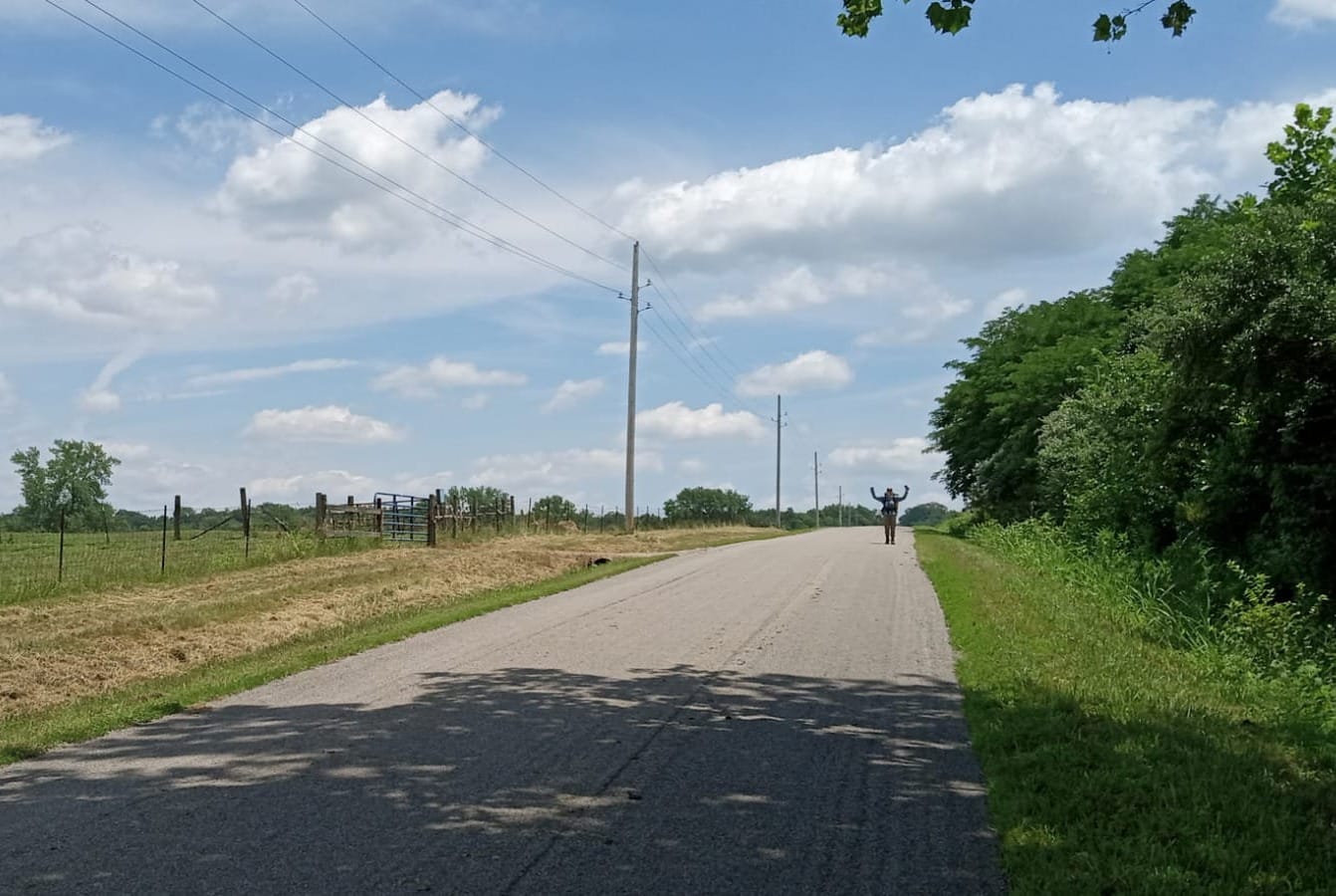
The American Discovery Trail stretches 6,800 miles across the country, and honestly – the planning used to feel just as daunting as the hiking itself. But that's changed.
At Hiking America, we've already done most of the heavy lifting for you. Our 13,000+ curated waypoints include turn-by-turn directions, notes from experienced hikers, water sources, resupply options, and even places previous hikers have stayed or eaten. Real information from real people who've walked these miles.
With this head start, you can focus on three key things: getting your body ready, selecting your gear, and determining your timing. That's it.

What Real-Time Trail Intelligence Looks Like
Just this week, we received updates from ADT hikers across multiple states that show exactly why having current, tested information matters. These aren't theoretical waypoints or outdated guidebook entries—this is what's actually working for people on the trail right now.
Rhiis & Sara
Westbound - Southern Route
Began: February 21, 2025
Support Links: ImHikingAmerica, TrailJournals, YouTube, Venmo
In Indiana, Rhiis and Sara discovered that The Loft Campground east of Meinrad lets hikers stay for free with permission. They also found a working water pump at the baseball diamond in Meinrad and confirmed a summer youth camp where hikers can camp year-round. Meanwhile, two Vrbo/Airbnb properties in Gentryville are now offering 15% discounts specifically to ADT hikers.

Stephen "SaunterinSteve" Gefell
Westbound - Southern Route
Began: February 23, 2025
Support Links: ImHikingAmerica, Instagram, YouTube
Over in Kansas, thru-hiker Steve Gefell made a discovery that'll probably matter more to your morale than your mileage: the Mango Con Chile popsicle at a restaurant in Lakin. His review?
"It's insane. Will have dreams about this for many nights!"
He also confirmed dispersed camping at the Hamilton County fairgrounds south of Syracuse—sheriff approved.
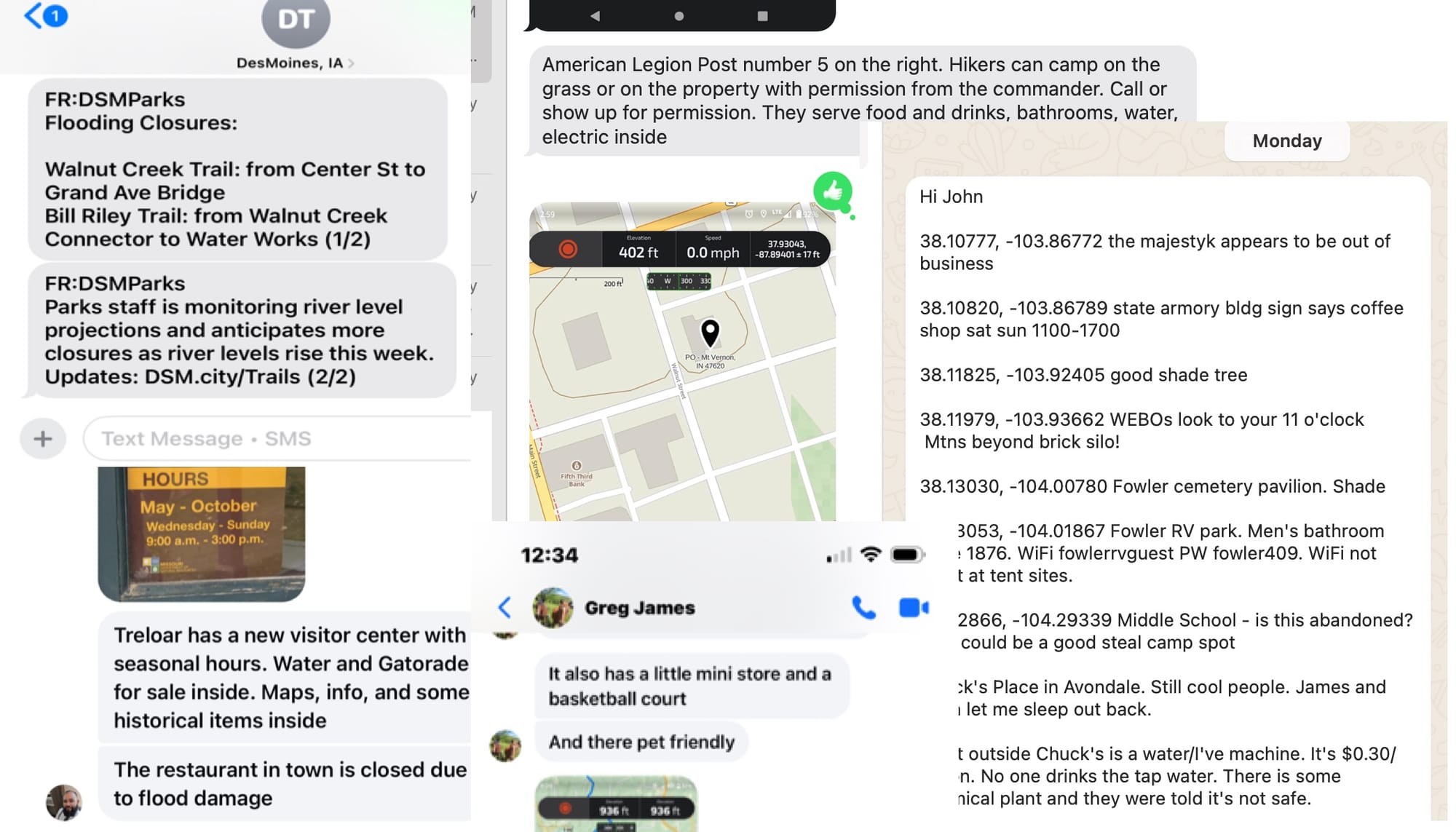
After crossing into Colorado, Steve's updates got more extensive. Steve confirmed that Chuck's Place in Avondale is still "filled with cool people" who invited him to sleep out back. More importantly, he learned about water issues in town—there's now a vending machine dispensing safe water due to concerns about local tap water from a nearby chemical plant.
He also discovered that dispersed camping is now illegal at John Martin Reservoir State Park since the Corps of Engineers took over operations. And then there are the details that matter when you're actually walking: shower codes at the Holly town park campground, potential stealth camping on a high school baseball field near Granada, and even a "dog report" east of Lamar for hikers dealing with aggressive animals.
In Missouri, "RayRey" Reynosa updated the hours and services at the AMVETS lodge in Mokane, so future hikers won't show up to locked doors. Plus, updates all along the Katy Trail from cold, cheap beer, a new visitors center in Trelor, a restaurant temporarily out of business due to flooding.
AND...

... caught sight of a B-2 bomber training over the Katy, which is south of Whiteman Air Force Base. Talk about an American Discovery!
Why This Matters More Than You Think
No more spending months trying to piece together scattered trail information or wondering if that water source is still reliable. No more guessing where you can actually get a decent meal in a trail town, or worse—arriving at a campground that no longer allows hikers.
When atmospheric rivers flooded the Ohio River this spring and shut down a key ADT crossing, thru-hiker Steve wasn't stranded. Our real-time waypoints guided him safely around the problem within hours. That's the kind of support that lets you focus on the adventure, not the logistics.
The Bottom Line
While other hikers are trying to figure out basic route-finding, you'll have turn-by-turn directions that account for recent trail connections and updates.
This is what happens when you have a network of hikers feeding real-time intelligence back to a central resource. It's not just about having maps—it's about having maps and data that reflect what's actually happening on the ground this season.
Ready to skip much of the overwhelming research phase and get straight to the good stuff? Check out HikingAmerica.com for GPS data and resources that give you a serious head start. ⛰️
Your trail intelligence is current. Your route is tested. Your adventure awaits. 🥾
Hike Your Hike - John.
📊 This Week's Summary
147 New Waypoints Added to Hiking America Database:
Hat-Tip - Rhiis & Sara, Steve Gefell, Ray Reynosa
- Indiana-South: 93 waypoints (campsites, water, services, new trail angel)
- Iowa: 26 waypoints (services, camping, new trail completion)
- Colorado-South: 18 waypoints (services, camping, food)
- Kansas: 9 waypoints (services, discoveries, camping)
- Maryland - 1 (Trail Angel)
Categories covered: Campsites, water sources, restrooms, restaurants, hazards, discoveries, trail angels, and local contacts 📍

ADT in the News