
Eastbound Season Opens, Trail Reroutes, and Class of '24 Updates
Sierra Nevada snow depth drops below three feet, and new trail segment routing updates. Plan your ADT hike with the latest info from HikingAmerica.com!

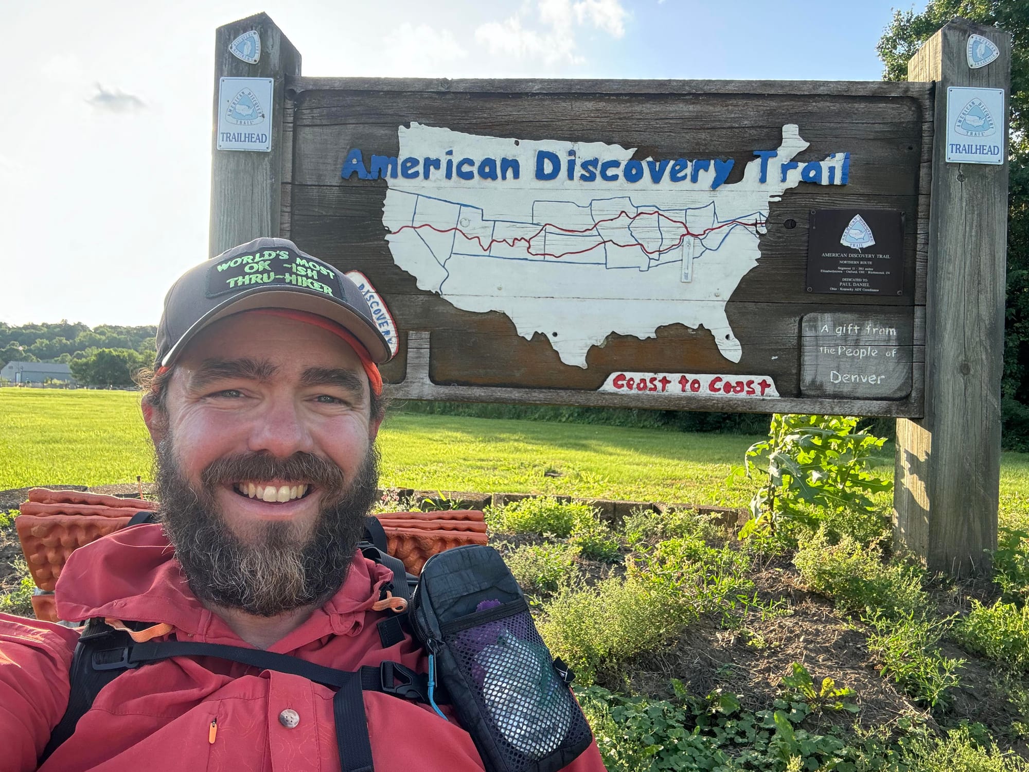
Congratulations to Matthew Hengst, who has successfully completed the Buckeye Trail's ADT segment and the entire Eastern Section of the American Discovery Trail!
Matthew has now embarked on the ADT Southern Route, starting in Indiana. His journey exemplifies the spirit of adventure and determination that defines the American Discovery Trail hiking community. You can follow his progress through near-daily vlogs as he continues to tackle this remarkable trail.


California

Sierra Nevada Snow Depth Update
We have good news for those planning an eastbound hike from Limantour Beach, California. According to the latest SNOTEL data, the snow depth in the Sierra has dropped to below three feet for the first time since the winter season began. This means that trail conditions should be more manageable by the time you reach the Sierras. You would arrive in just over three weeks at an average speed of 15 miles per day.
Ohio
Segment 2

We've rerouted the trail to align with recent changes made to the Buckeye Trail in and around Milford. The trail moves off a dangerous section of Round Bottom Road and relocates it through Finley Ray Park. An additional benefit is that the new path passes by a Walmart Supercenter, restaurants, and a hotel for those needing services at the Southwestern End of the Buckeye Trail...and on a sidewalk, not the road.
As a result of the reroute, we've renumbered the entire segment and added 19 new waypoints for both directions and services.
Iowa
Segment 2
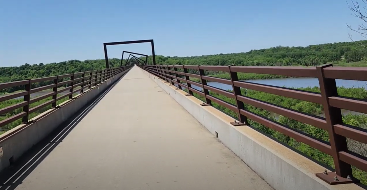
Out west, Marshall Travis continues moving through Iowa this week and took advantage of the recently opened High Trestle Trail that connects with the Raccoon River Trail in the center part of the state. The High Trestle Trail Bridge is a striking and popular landmark located in central Iowa.
One of the most distinctive features of the bridge is its artistic design. The bridge features 41 steel frames that form decorative towers and cribs along its length. At night, the bridge is illuminated with LED lights, creating a stunning visual effect that simulates passing through a mine shaft, reflecting the region's coal mining history.
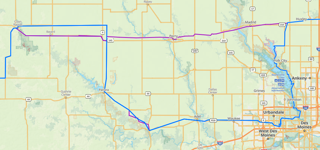
Although not officially recognized (yet) as part of the American Discovery Trail, one can immediately tell the advantages of the High Trestle Trail as it provides a near direct East-West route across Iowa, passing through several new and active 'trail towns.'
We have added the track as an alternate in our Gaia GPS data. Because, as we like to say, "When you're hiking 6,800 miles - it's nice to know your options!"
Hike Your Hike - John.
Trail Mix.
[PARTNERS]

